top of page

AB Terrestrial
LiDAR Surveying
For Architectural and As-Built Survey.
Terrestrial LiDAR Scanning is for measuring distances of objects through the use of pulsed laser operation. This is useful for As-Builts, 3D Modeling, and ALTA surveys.
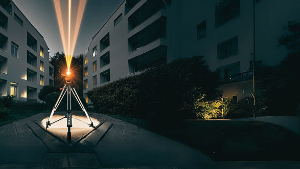
Aiming for the most precise architectural as-built survey, AB Surveying & Development is the among the first in the country to use the FARO Focus 3D X330 Scanner for commercial survey purposes. Capable of up to 976,000 meas/sec, the Focus 3D X330 captures every important architectural detail. ABSD's terrestrial LiDAR capabilities can produce reliable life-like visualization, even under extreme light conditions or enormous distances .
AB Surveying & Development uses FARO Focus 3D X330 Laser Scanner
What's making Terrestrial LiDAR Scanning Possible?

Click here for more information on the FARO Focus 3D X330 Laser Scanner.
CAPABILITIES
OUR PROJECTS


bottom of page